MARAEROA C INCORPORATION
Introduction
Ko Tainui te waka
Tainui is the canoe
Ko Rereahu te Iwi
Rereahu are the people
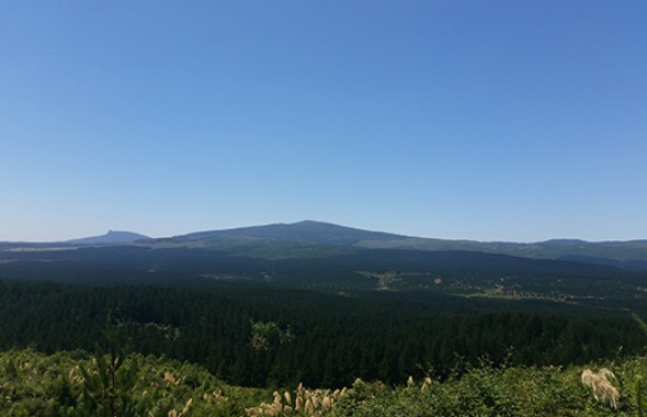
Ko Pureora te maunga
Pureora is the mountain
Ko Waimiha te awa
Waimiha is the river
Ko Maraeroa te whenua
Maraeroa is the land
Tihei Mauri Ora!
The breath of life!
Maraeroa C Incorporation
“The Proprietors of Maraeroa C Block Incorporation” was established at a sitting of the Court held in Hamilton on 18 December 1970, to receive the land asset and to manage the land for the benefit of the descendants of the original owners of the land. Today, Maraeroa C Incorporation is governed by a Management Committee of seven people appointed by the beneficial owners. A Chief Executive has also been employed to manage the business of the Incorporation with the assistance of several staff. Maraeroa C has it’s own office premises in central Te Kuiti and today has investments in Property, Shares and new business ventures. Maraeroa C Incorporation's core business however is exotic plantation forestry which is managed by way of a lease/partnership arrangement with Hancock Natural Resource. Harvesting of the first rotation crop of pinus radiata is almost complete with planting of the second rotation crop well under way. The new business ventures developed over the past 4 years, include: Administration Services, Pa Harakeke Tourism, Pureroa Mountain Ginseng.
Maraeroa Lands
Maraeroa C Block comprises 13,767 acres and is situated in the Pureora region of the King Country. It is located on the southwest boundary of Pureora Forest, between State Highway 30 and the Ongarue River. The contour ranges from flat to steep, with a general south westerly aspect whilst the soil type is predominantly Taupo Ash. The block was cut over bush country when the land was returned to Maraeroa whanau (families) by the government of the day and whilst the families rejoiced about the return of the land, concern remained for the greater land area retained by the Crown, some 34,000 acres. Maori Land Court records show that the orginal Maraeroa Block surveyed in 1891 consisted of approximately 47,975 acres. The Maraeroa boundary markers were recorded as follows: “Beginning at Tapararoa then turning slightly west to Nga Turi o Hinetu, southwest to Pukemako, continuing in a southerly direction to Ketemaringi, from here a change eastward to Pakihi. On the Hauhungaroa range and down towards the western bays of Lake Taupo and Tuhingamata. The line returns on a northerly route to Weraroa on to Tahora Karewarewa, up onto Pureora Mountain and finally back to where it began at Tapararoa. This was Maraeroa in 1891 prior to the partioning of Maraeroa A, B and C.
Maraeroa History
Prior to the 20th century, Maraeroa was well inhabited. People from a number of tribes, including Te Arawa, T?wharetoa and Ng?ti Raukawa, would occupy Maraeroa at various times of the year to gather food. Raukawa, a Chief and descendant of the people of the Tainui canoe, was the father of Rereahu, the Chief of those descendants who inhabited the Maraeora lands. It is with Rereahu that the families of Maraeroa commonly affiliate. Rereahu’s son, Maniapoto, is a particularly well-known ancestral chief in New Zealand. According to our Tupuna (ancestor) `Duke Te Manawanui-O-Rangi Crown (1899-1978) the name Maraeroa was given as it reflected the hospitable nature of the area, also it's generosity, and ability to provide sustenance for the people. The vast array of food resources, “described in his own words”, (he kono kai) a virtual basket of food. Some of the common foods of the time included: ‘Pitau’, the large leaves of the Mamaku (a black tree fern) cooked in a hangi (earth oven); ‘Toi’, a sweet food from a mountain flax; ‘t? k?uka’, food from a cabbage tree; and ‘pikopiko’ (a type of fern frond). There was also a variety of fish life including Marearea (native trout) and Koaru.

